PRESENTATION ARCHIVE

OVERVIEW

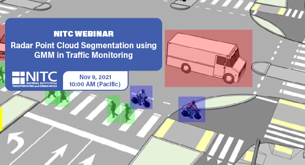
Intelligent transportation systems (ITS) change our communities by improving the safety and convenience of people’s daily mobility. The system relies on multimodal traffic monitoring, that needs to provide reliable, efficient and detailed traffic information for traffic safety and planning. How to reliably and intelligently monitor intersection traffic with multimodal information is one of the most critical topics in intelligent transportation research.

In multimodal traffic monitoring, we gather traffic statistics for distinct transportation modes, such as pedestrians, cars and bicycles, in order to analyze and improve people’s daily mobility in terms of safety and convenience.

In this study, we use a high-resolution millimeter-wave (mmWave) radar sensor to obtain a relatively richer radar point cloud representation for a traffic monitoring scenario. Based on a new...

Read more
Watch condensed webinar preview video

Watch full webinar video

View slides

Findings from a Quasi-Experimental Study of Boltage Encouragement Programs

Much of the...

Read more

The video begins at 1:37.

View slides

Summary: Signalized intersections often rely on vehicle detection to determine when to give a green light. The 2009 Manual of Uniform Traffic Control Devices (MUTCD) includes an on-pavement marking and curbside sign that public agencies can use to indicate where cyclists should position themselves while waiting at an intersection. This presentation reviews the effectiveness of current markings, signs, and other methods used to help cyclists properly position themselves over detection.

Stefan Bussey is an undergraduate civil engineering student at Portland State University. He is interested in exploring how road users’ interactions with each other and the built environment affect the efficiency and safety of road networks. He currently works as a civil design intern at Harper Houf Peterson Righellis Inc. 

This seminar will present results from the BikeGPS study that collected data from Portland area bicyclists using GPS technology. The study collected data from over 150 cyclists for seven days each during 2007, resulting in detailed information for over 1,500 bicycle trips throughout the urban area. The GPS data provides detailed information on the amount, location, and speed of bicycle travel and allows us to answer questions about route choice. For example, how much to people ride on roads with bike lanes, on bike boulevards, or paths? Do these patterns vary by gender, age, or other factors?

View slides

The video begins at 7:24.

PRESENTATION ARCHIVE

OVERVIEW

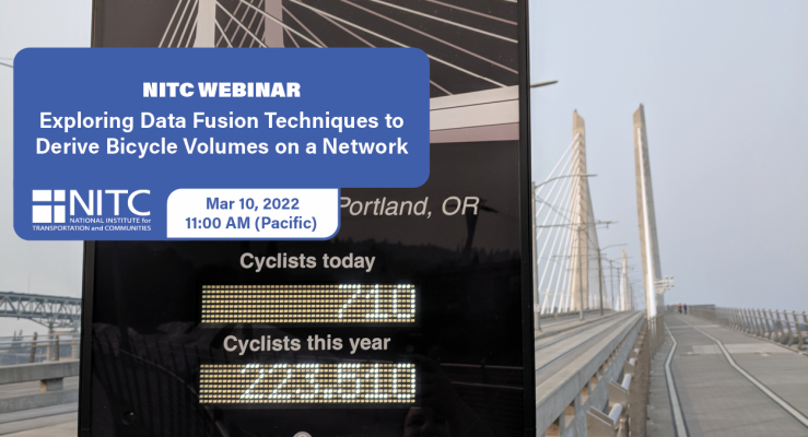
Planners and decision makers have increasingly voiced a need for network-wide estimates of bicycling activity. Such volume estimates have for decades informed motorized planning and analysis but have only recently become feasible for non-motorized travel modes.

Recently, new sources of bicycling activity data have emerged such as Strava, Streetlight, and GPS-enabled bike share systems. These emerging data sources have potential advantages as a complement to traditional count data, and have even been proposed as replacements for such data, since they are collected continuously and for larger portions of local bicycle networks. However, the representativeness of these new data sources has been questioned, and their suitability for producing bicycle volume estimates has yet to...

Read more

The video begins at 0:34.

View slides

Speaker: Joseph Broach, Ph.D. Candidate, Portland State University
Topic: Trick or Treatment? Impact of Route-Level Features on Decisions to Walk or Bike
Summary: Some travel routes attract people walking and cycling, while others may scare them away. What features of street environments are most important, and how do available routes affect decisions to bike or walk on a specific trip? 

Research to date has focused on either large-scale areal measures like "miles of bike lane nearby" or else has considered only shortest path routes. Neither method is suited to capturing the impact of targeted route-level policies like neighborhood greenways. This session will present a new technique for measuring bike and walk accessibility along the most likely route for a given trip. The method is applied to travel data, and results provide new insight into the relationship between route quality and travel mode choice.

Pages