View slides
If you would like to receive continuing education credits such as PDH or CM, please make sure to complete this evaluation form once you've watched the entire video so that we have a record of your attendance.
Watch video:
Read moreView slides
If you would like to receive continuing education credits such as PDH or CM, please make sure to complete this evaluation form once you've watched the entire video so that we have a record of your attendance.
Watch video:
Read moreWatch video
View slides
Topic: Airsage cell phone data and its application in travel modeling
Summary: As part of the initial phase of development for the Idaho Statewide Travel Demand Model, Parsons Brinckerhoff developed a base year auto and truck trip matrix using AirSage cell phone OD data, a statewide network in Cube, traffic counts, and origin-destination matrix estimation (ODME) procedures. To begin, the 4000+ statewide zone system was aggregated into a 700 super zone system for collecting the cell phone OD data. Next, the cell phone data was collected for the month of September 2013 for the following market segments: Average weekday resident HBW, HBO, NHB, and visitor NHB trips. The cell phone trips were then disaggregated to zones using each zone’s share of super zone population and employment. These initial trip matrices were assigned to the daily statewide network using free flow travel time for route impedance and iteratively adjusted to minimize the difference between the estimated link volumes and traffic counts by user class.
This iterative trip matrix balancing procedure, also known as ODME, converged nicely by user class and facility type and produced reasonable flows. The resulting trip matrix trip length frequencies matched fairly well with the...
Read moreThe video begins at 2:15.
View slides
Abstract: TriMet has used a computer aided dispatch (CAD)/automatic vehicle location (AVL) system to manage bus and rail operations since the late 1990s. TriMet is currently in the process of updating the CAD/AVL system, and anticipates improvements in bus tracking and performance monitoring. This presentation will show how TriMet uses data from the system to support intelligent transportation systems (ITS) such as TransitTracker and automatic stop announcements in buses and trains, as well as to analyze transit operations such as on time performance and passenger loads.
Speaker Bios: Steve Callas is the Manager of Service and Performance Analysis at TriMet in Portland Oregon, where he is responsible for operations performance monitoring and analysis. This includes analyzing TriMet’s comprehensive automatic vehicle location and automatic passenger counter data archive. Additionally, Steve is involved in various transit operations research projection in conjunction with Portland State University and OTREC. Steve has been with TriMet for over 15 years.
David is an operations analyst with TriMet. He is involved in AVL data mining and analysis, safety analysis, automatic stop announcements, transit signal priority, and real-time...
Read moreView slides
Watch video:
New technologies such as smart phones and web applications constantly collect data on individuals' trip-making and travel patterns. Efforts at using these "Big data" products, to date, have focused on using them to expand or inform traditional travel demand modeling frameworks; however, it is worth considering if a new framework built to maximize the strengths of big data would be more useful to policy makers and planners.
In this presentation Greg Macfarlane will present a...
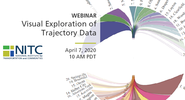
Read moreThis webinar will demonstrate the tremendous value of GPS trajectory data in understanding statewide travel patterns and measuring performance. First, Dr. Markovic (U of Utah) will conduct visual exploration of GPS trajectories that capture about 3% of all the trips in Utah. He will briefly discuss the problem of scaling GPS trajectories to the population, and then focus on the use of scaled trajectories in computing origin-destination matrices, vehicle-hours delays, vehicle-miles traveled, and trip-based performance measures. Second, Dr. Franz (CATT Lab) will demonstrate a suite of visual analytics that enables transportation agencies to easily explore terabytes of GPS trajectory data. He will demonstrate different tools and share the experience of 5 state DOTs that are currently using CATT Lab's trajectory data suite.
Watch video
View slides
Transportation and Road Weather
Where: Room 204 of the Distance Learning Center Wing of the Urban Center at PSU
Speaker: Rhonda Young, University of Wyoming
Topic: Transportation and Road Weather
Summary: Weather has a tremendous impact on the transportation system and is one of the largest contributors to non-recurring delay and increased crashes. Road weather is the a multidisciplinary area involving transportation engineers and meteorologists who are working to mitigate the negative effects of weather on the operation and maintenance practices of transportation systems. The talk covers the broad types of issues being studied in this field and looks at ways in which technology is playing a large part in the proposed solutions. The issue of weather as a complicating factor in the use of connected and autonomous vehicle technologies is also discussed.
Bio: Rhonda Young is an associate professor in the Department of Civil and Architectural Engineering at the University of Wyoming since 2002 and teaches graduate and undergraduate classes in Traffic Operations, Transportation Planning, Transportation Design and Traffic Safety. She completed her master and PhD degrees in Civil Engineering at the University of Washington and...
Read moreThe video begins at 1:55.
View slides
Abstract: Traffic counts are an important piece of information used by transportation planners; however, while count programs are common for motor vehicles most efforts at counting non-motorized traffic – cyclists and pedestrians – are minimal. Long-term, continuous counts of non-motorized traffic can be used to estimate month of year and day of week adjustment factors that can be used to scale short-duration counts to estimates of annual average daily traffic. Here we present results from continuous counts of non-motorized traffic at 6 locations on off-street trails in Minneapolis, MN using two types of automated counters (active infrared and inductive loop detectors). We found that traffic volumes varied significantly by location, but the month of year and day of week patterns were mostly consistent across locations and mode (i.e., cycling, walking, or mixed mode). We give examples of how this information could be used to extrapolate short-duration counts to estimates of annual average daily traffic as well as Bicycle Miles Traveled (BMT) and Pedestrian Miles Traveled (PMT) for defined lengths of off-street trails. More research is needed to determine if non-motorized traffic patterns (and subsequently our adjustment factors) for off-street...
Read more